Portfolio
Projects
Data products I have built — spanning disease forecasting, public health analytics, HDSS, predictive modeling, geospatial analysis, and dashboards.
Disease Forecasting · Shiny
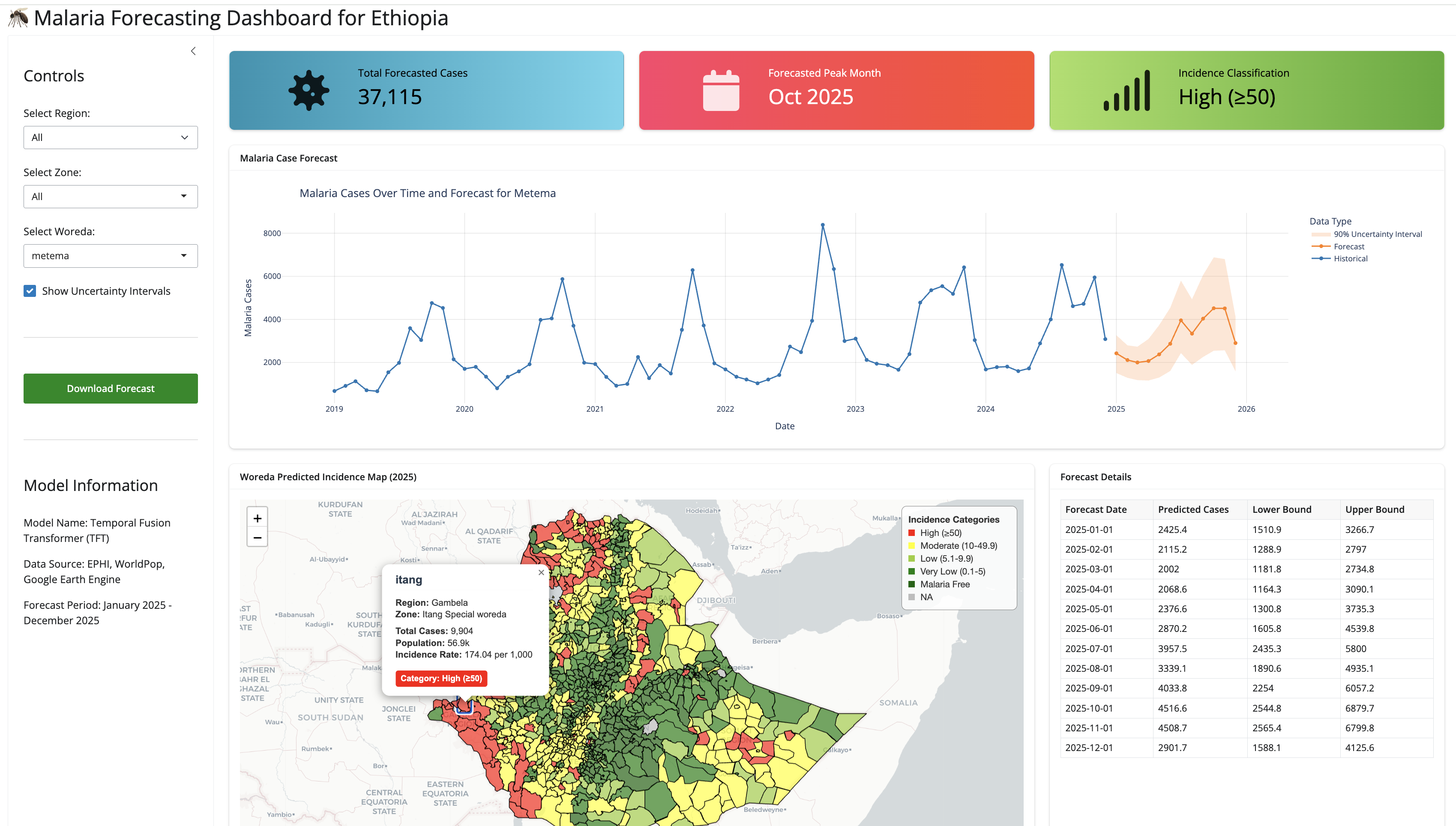
Malaria Forecasting Dashboard
An interactive malaria forecasting dashboard for public health monitoring and decision support. Built with R / Python Shiny, it provides real-time visualization of forecasted incidence trends and supports woreda-level, regional, and national decision-making.
Public Health · HDSS
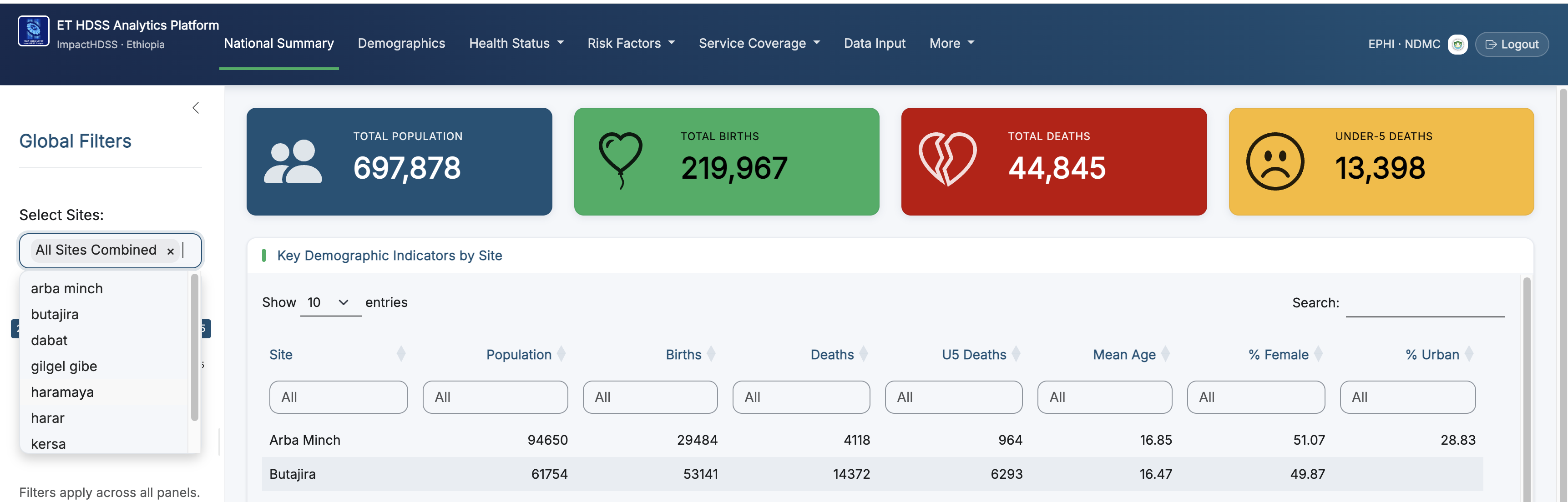
impactHDSS Analytics Platform
Analytics & Visualization team lead for the impactHDSS project — a multi-site Health & Demographic Surveillance System. Led development of analytics pipelines and dashboards that turn longitudinal population data into actionable insight.
Surveillance · Early Warning
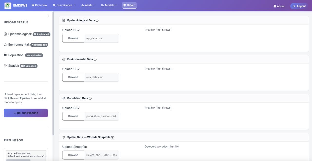
EWARS — Early Warning & Response
Lead data scientist for an Early Warning and Response System: designing outbreak-detection algorithms and integrating multi-source surveillance data to flag public health threats earlier.
Machine Learning
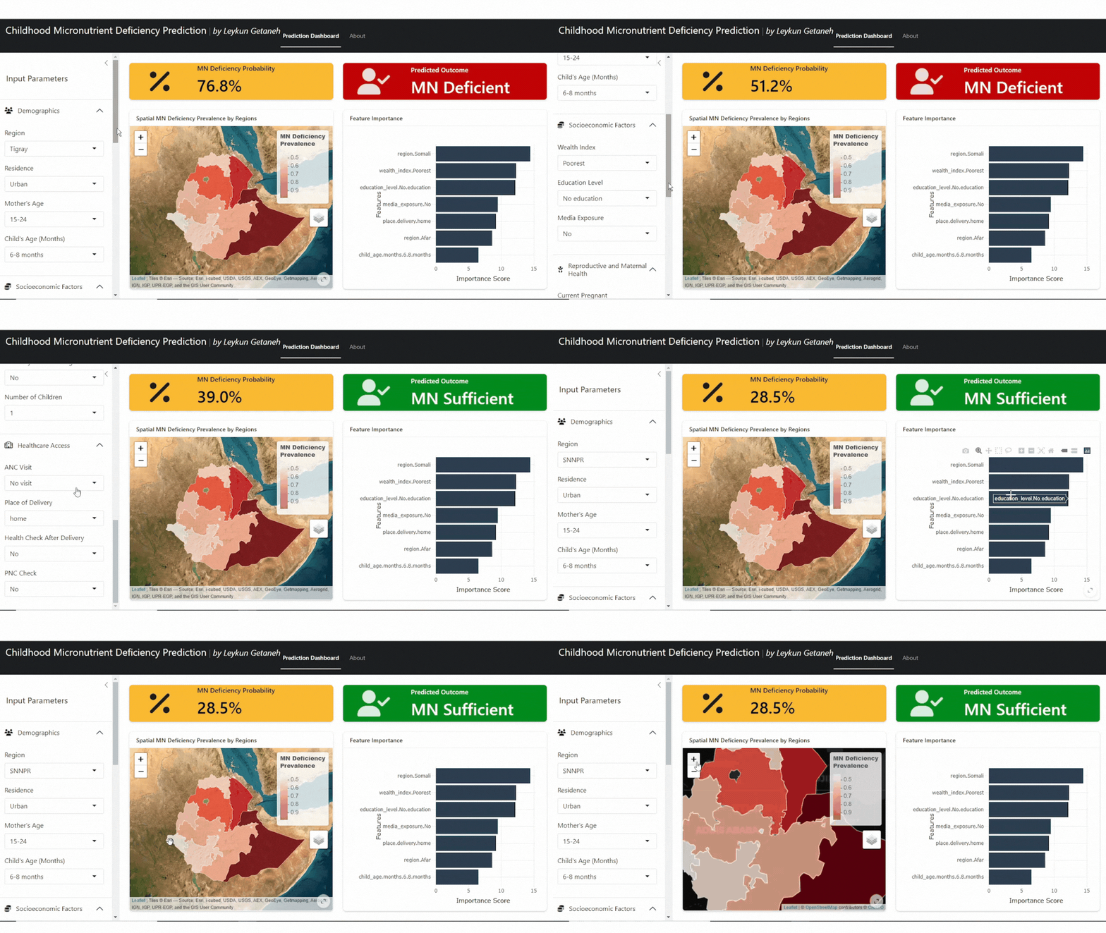
Childhood Micronutrient Deficiency Prediction
An interactive prediction tool built with R Shiny that predicts childhood micronutrient deficiency using machine learning. Employs an XGBoost model trained on demographic and health-related features, developed with the Tidymodels framework.
Machine Learning
Customer Churn Prediction App
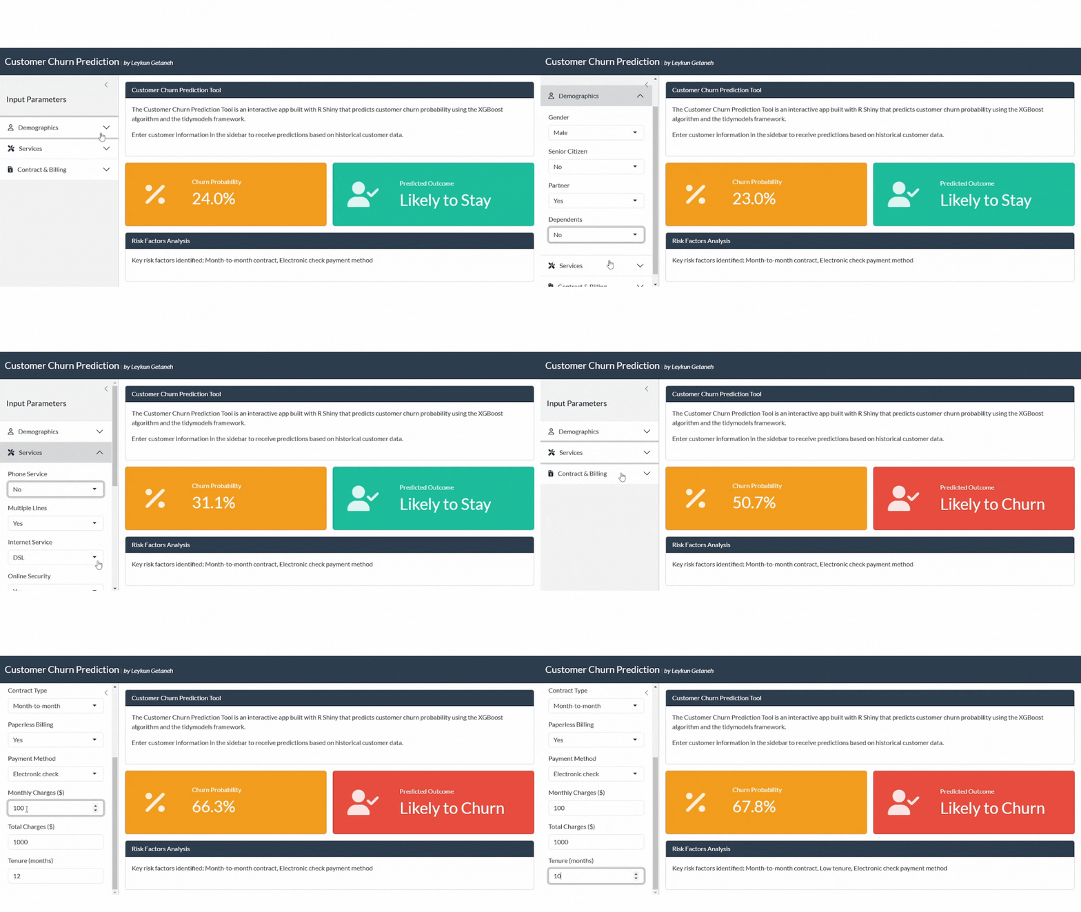
An interactive churn prediction tool built with R Shiny for the telecommunications sector. Uses XGBoost with the Tidymodels framework to analyze customer attributes and behaviors, providing insight into churn probability.
Geospatial · Real-time
Ethiopia Earthquake Tracker
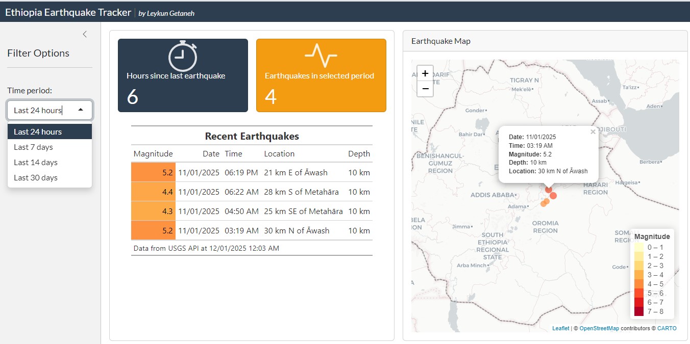
A real-time web application monitoring seismic activity across Ethiopia, built with R Shiny. Features live earthquake tracking via USGS, interactive map visualization, auto-refresh every 5 minutes, and magnitude-range filtering.
Geospatial · Public Health
Spatial Distribution of Childhood MN Deficiency
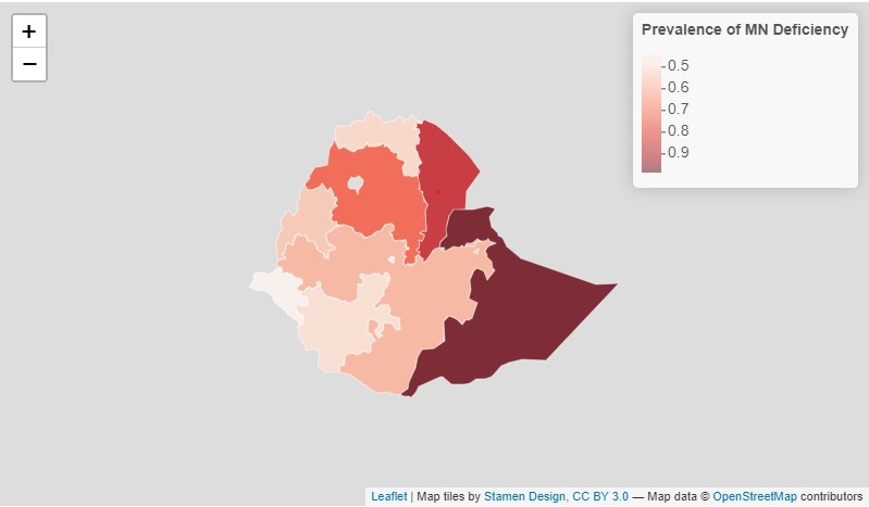
An interactive spatial map showing that childhood micronutrient deficiency in Ethiopia is most prevalent in the Somali, Afar, and Amhara regions, while Gambela, Addis Ababa, and SNNP have the lowest prevalence.

Dashboard
COVID-19 Dashboard: The Case of Ethiopia
A comprehensive overview of the COVID-19 epidemic in Ethiopia. Built with R and the Quarto framework, this dashboard provides epidemiological trends, case statistics, and visualizations for evidence-based public health response.